Published:
100 000 SEK to develop Urbania
The PhD project Comparing planning systems led by Hye Kyung Lim has been granted 100 000 SEK from the Adlerbertska Foundation to develop an extension of Urbania.
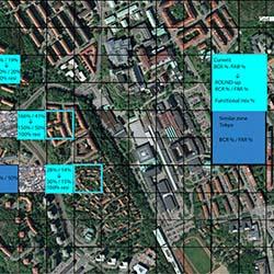
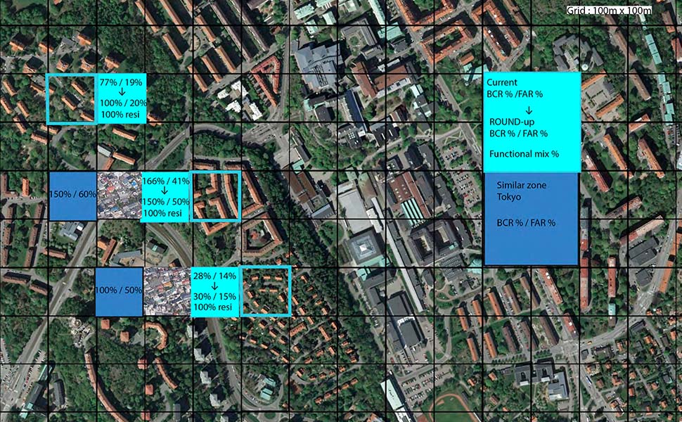
The web-based and interactive dialogue tool Urbania is based on Google maps and users can leave their comments and pictures connected to different sites in the city. The extension of the tool will embed urban cell grids directly onto the satellite map. By clicking on a cell, the data is linked to the specific urban surface area rather than on a precise point. The tool will be used to facilitate surveying opinions and perceptions about perceived density and the heterogeneity of urban functions in relation to the typology of built environment at the location directly on the maps in real-time. Workshops will be conducted and the tool will be developed by spring 2014.
The aim is to be able to compare urban planners, developers and the general public perceptions on density with existing GIS (Geographical Information Systems) data. To better understand the perception of dense and sprawled areas as well as the distributions of mixed functions, public areas and green areas is another aim.
Urbania has been developed by Mistra Urban Futures together with the Swedish Transport Administration and the City of Gothenburg.
Read more
The PhD project Comparing planning systems
Previous news about Urbania